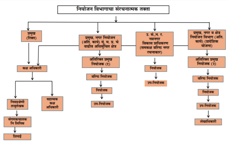
inner-banner

Planning

dummy-img

Shri. Milind Patil
Chief (Addl Charge),
Planning Division

Planning Division looks after Regional Planning, Development Financing and planning for areas where Government of Maharashtra has appointed MMRDA as a Special Planning Authority (SPA).

Regional Planning

MMRDA was established for implementation of the Regional Plan and for Planning, Development and Co-ordination of Development within the Mumbai Metropolitan Region (MMR). The Mumbai Metropolitan Region was delineated and subsequently, the first Regional Plan for MMR was sanctioned in 1973. Thereafter, considering various planning aspects, the Authority prepared the revised Regional Plan for the period 1996-2011 which was sanctioned by the State Government on 23rd September, 1999 and came into force with effect from 1st December, 1999.

Following the 74th Constitutional Amendment, the function of Metropolitan Planning is assigned to the Mumbai Metropolitan Planning Committee (MMPC) and MMRDA is to assist in this task. As directed by the MMPC, the draft Mumbai Metropolitan Regional Plan, 2016-36 was prepared and published for inviting suggestions and objections from the public on 19th September, 2016. Following the procedure laid down under the MR&TP Act, 1966, based on the suggestions and objections received and the Planning Sub-Committee's report, MMRDA submitted the modified draft Regional Plan to the Mumbai Metropolitan Planning Committee on 30th October, 2017. The MMPC has approved the same with appropriate modifications and submitted to the GoM for its sanction. The Government, vide its Notification dated 7th August, 2019 has sanctioned a part of the Regional Plan, 2016-36 pertaining to Matheran Eco-Sensitive Zone.Thereafter the final Regional Plan was sanctioned by Government vide notification dated 20th April, 2021 under Section 15(1) of the MR&TP Act, 1966 the said Plan came into force from 19th June, 2021

Development Financing

MMRDA's functions involve preparing and financing projects of Regional significance, extending financial and technical assistance to Urban Local Bodies, Zilla Parishads (for rural infrastructure) and other infrastructure implementing agencies and coordinating multi-agency projects in the MMR. Financing of Infrastructure Projects is carried out by Planning Division through the following funds :

  • Mumbai Metropolitan Region Development Fund (MMRD Fund)
  • Mega city Scheme Revolving Fund (MCS-RF)
  • Mumbai Urban Development Project - Revolving Fund (MUDP-RF)

Village Development

With view to implements the integrated village development Scheme for rural areas, a detailed survey of the village in the region is underway.

Planning for SPA areas (through Sub-Regional Office, Thane)

Planning of following areas is undertaken by Planning Division through its Sub-Regional Office in Thane, where Government of Maharashtra has appointed MMRDA as a Special Planning Authority.

Planning

  • Assistance to Mumbai Metropolitan Planning Committee (MMPC) in preparation of Regional Plan
  • Implementation of the Regional Plan
    • Clarifications/issuing NOCs for Development Permissions
    • Advise on proposals received from the Government pertaining to change in land-use and/or Development Control Regulations.
  • Advise Government of Maharashtra on new regulations and schemes
  • Representation on Committees for Regional Planning and Development
  • Development Financing
  • Development co-ordination for multi-agency schemes
  • Technical assistance to ULBs and other agencies
  • Assisting GoI and GoM on Urban Development, Housing and other matters

The Mumbai Metropolitan Planning Committee (MMPC) was formed in the year 2009 and in its second meeting held on 11th June, 2010, the MMPC formed five study groups to prepare respective Study Group Reports

The five study-group reports thus prepared established the status of the Region based on which, projections up to 2036 are made. Accordingly, the Draft Regional Plan, 2016-36 is prepared and published on 19th September, 2016 for inviting suggestions and objections from the public under section 16 of the MR & TP Act, 1966. The last date for receipt of such suggestions/objections was 25th April, 2016.

Based on the suggestions and objections received and the Planning Sub-Committee's Report,after following the procedure laid down under the MR & TP Act, 1966, MMRDA submitted the modified Draft Regional Plan to the MMPC on 30th October, 2017. The MMPC has approved the same with appropriate modifications and submitted to the Government of Maharashtra for sanction. The Government vide its Notification dated 7th August, 2019 has sanctioned a part of the Regional Plan, 2016-36 pertaining to Matheran Eco-Sensitive Zone. The remaining part of MMR Regional Plan is sanctioned by Government vide notification dated 20th April, 2021 and is in force from 20th June, 2021.

The details of notifications and contents of Final Regional Plan can be downloaded from the links below:

(A) Final Zonal Master Plan (ZMP) of Matheran Eco-Sensitive Zone (MESZ)

v) List of Affected survey numbers  

Attachment Size
List of Affected survey numbers 637.86 KB

vi) Zonal Master Plan Report for Matheran Eco-sensitive Zone (MESZ), 2016-36   

(B) Sanctioned Unified Development Control and Promotion Regulations for Maharashtra State 2020 (UDCPR), applicable to MMR except for MCGM, Matheran ESZ.

(C) Final Regional Plan for MMR, April 2021

MMR Regional Plan is sanctioned by Government vide notification dated 20th April,2021 and is in force from 20th June, 2021.

Attachment Size
Notification Dated 20.04.2021 56.92 MB

Maps Published:

Attachment Size
Index sheet showing village-wise sheet nos. 30.15 MB
Proposed Landuse (1:1,00,000) 29.71 MB
1.Proposed Land-use map no. 1 for Alibag Taluka 19.42 MB
2.Proposed Land-use map no. 2 for Alibag Taluka 17.69 MB
3.Proposed Land-use map no. 3 for Alibag-Pen Talukas 21.69 MB
4.Proposed Land-use map no. 4 for Pen Taluka 28.84 MB
5.Proposed Land-use map no. 5 for Pen Taluka 13.53 MB
6.Proposed Land-use map no. 6 for Alibag Taluka 20.03 MB
7.Proposed Land-use map no. 7 for Alibag Taluka 23.28 MB
8.Proposed Land-use map no. 8 for Pen-Uran Talukas 28.21 MB
9.Proposed Land-use map no. 9 for Pen Taluka 19.83 MB
10.Proposed Land-use map no. 10 for Panvel-Pen Talukas 10.27 MB
11.Proposed Land-use map no. 11 for Uran Taluka 18.65 MB
12.Proposed Land-use map no. 12 for Uran Taluka 19.1 MB
13.Proposed Land-use map no. 13 for Panvel-Uran Talukas 32.65 MB
14.Proposed Land-use map no. 14 for Khalapur-Panvel Talukas 27.59 MB
15.Proposed Land-use map no. 15 for Khalapur-Panvel Talukas 26.03 MB
16.Proposed Land-use map no. 16 for Karjat-Khalapur Talukas 31.51 MB
17.Proposed Land-use map no. 17 for Karjat-Khalapur Talukas 22.32 MB
18.Proposed Land-use map no. 18 for Karjat-Khalapur Talukas 11.74 MB
19.Proposed Land-use map no. 19 for Panvel Taluka 25 MB
20.Proposed Land-use map no. 20 for Panvel Taluka 29.52 MB
21.Proposed Land-use map no. 21 for Khalapur-Panvel Talukas 25.19 MB
22.Proposed Land-use map no. 22 for Karjat-Khalapur Talukas 27.13 MB
23.Proposed Land-use map no. 23 for Karjat Taluka 16.04 MB
24.Proposed Land-use map no. 24 for Karjat Taluka 18.46 MB
25.Proposed Land-use map no. 25 for Karjat Taluka 10.98 MB
26.Proposed Land-use map no. 26 for Karjat Taluka 15.39 MB
27.Proposed Land-use map no. 27 for Panvel Taluka 18.9 MB
28.Proposed Land-use map no. 28 for Panvel Taluka 24.14 MB
29.Proposed Land-use map no. 29 for Karjat Taluka 25.4 MB
30.Proposed Land-use map no. 30 for Thane Taluka 16.61 MB
31.Proposed Land-use map no. 31 for Panvel Taluka 14.89 MB
32.Proposed Land-use map no. 32 for Panvel Taluka 23.99 MB
33.Proposed Land-use map no. 33 for Ambernath Taluka 20.71 MB
34.Proposed Land-use map no. 34 for Ambernath-Karjat Taluka 21.63 MB
35.Proposed Land-use map no. 35 for Ambernath Taluka 15.4 MB
36.Proposed Land-use map no. 36 for Ambernath Taluka 15.47 MB
37.Proposed Land-use map no. 37 for Ambernath-Kalyan Talukas 16.84 MB
38.Proposed Land-use map no. 38 for Bhiwandi Taluka 16.63 MB
39.Proposed Land-use map no. 39 for Bhiwandi-Kalyan Talukas 12.02 MB
40.Proposed Land-use map no. 40 for Bhiwandi-Kalyan Talukas 18.49 MB
41.Proposed Land-use map no. 41 for Bhiwandi-Kalyan Taluka 14.57 MB
42.Proposed Land-use map no. 42 for Kalyan Taluka 13.21 MB
43.Proposed Land-use map no. 43 for Vasai Taluka 13.31 MB
44.Proposed Land-use map no. 44 for Bhiwandi Taluka 20.2 MB
45.Proposed Land-use map no. 45 for Bhiwandi Taluka 19.78 MB
46.Proposed Land-use map no. 46 for Bhiwandi Taluka 16.6 MB
47.Proposed Land-use map no. 47 for Bhiwandi Taluka 20.01 MB
48.Proposed Land-use map no. 48 for Bhiwandi Taluka 21.93 MB
49.Proposed Land-use map no. 49 for Bhiwandi Taluka 21 MB
50.Proposed Land-use map no. 50 for Vasai Taluka 17.63 MB
51.Proposed Land-use map no. 51 for Bhiwandi Taluka 17.07 MB
52.Proposed Land-use map no. 52 for Bhiwandi Taluka 15.54 MB
53.Proposed Land-use map no. 53 for Bhiwandi Taluka 18.08 MB
54.Proposed Land-use map no. 54 for Bhiwandi Taluka 16.02 MB
55.Proposed Land-use map no. 55 for Vasai Taluka 7.65 MB

Maps Prepared For Reference (Without Modifications):

Attachment Size
Index sheet showing village-wise sheet nos. 30.1 MB
Ref Proposed Landuse (1:1,00,000) 30.57 MB
1.Proposed Land-use ref map no. 1 for Alibag Taluka 23.96 MB
2.Proposed Land-use ref map no. 2 for Alibag Taluka 23.06 MB
3.Proposed Land-use ref map no. 3 for Alibag-Pen Talukas 22.88 MB
4.Proposed Land-use ref map no. 5 for Pen Taluka 13.9 MB
5.Proposed Land-use ref map no. 6 for Alibag Taluka 27.08 MB
6.Proposed Land-use ref map no. 7 for Alibag Taluka 24.55 MB
7.Proposed Land-use ref map no. 17 for Karjat-Khalapur Talukas 24.27 MB
8.Proposed Land-use ref map no. 18 for Karjat-Khalapur Talukas 13.65 MB
9.Proposed Land-use ref map no. 22 for Karjat-Khalapur Talukas 27.11 MB
10.Proposed Land-use ref map no. 23 for Karjat Taluka 19.88 MB
11.Proposed Land-use ref map no. 24 for Karjat Taluka 22.04 MB
12.Proposed Land-use ref map no. 25 for Karjat Taluka 15.19 MB
13.Proposed Land-use ref map no. 26 for Karjat Taluka 20.68 MB
14.Proposed Land-use ref map no. 29 for Karjat Taluka 24.36 MB
15.Proposed Land-use ref map no. 33 for Ambernath Taluka 20.31 MB
16.Proposed Land-use ref map no. 34 for Ambernath-Karjat Taluka 22.15 MB
17.Proposed Land-use ref map no. 35 for Ambernath Taluka 20.15 MB
18.Proposed Land-use ref map no. 36 for Ambernath Taluka 19.43 MB
19.Proposed Land-use ref map no. 37 for Ambernath-Kalyan Talukas 23.3 MB
20.Proposed Land-use ref map no. 38 for Bhiwandi Taluka 20.83 MB
21.Proposed Land-use ref map no. 39 for Bhiwandi-Kalyan Talukas 15.61 MB
22.Proposed Land-use ref map no. 40 for Bhiwandi-Kalyan Talukas 22.83 MB
23.Proposed Land-use ref map no. 41 for Bhiwandi-Kalyan Talukas 17.02 MB
24.Proposed Land-use ref map no. 42 for Kalyan Taluka 16.08 MB
25.Proposed Land-use ref map no. 43 for Vasai Taluka 14.17 MB
26.Proposed Land-use ref map no. 44 for Bhiwandi Taluka 21.05 MB
27.Proposed Land-use ref map no. 45 for Bhiwandi Taluka 21.22 MB
28.Proposed Land-use ref map no. 46 for Bhiwandi Taluka 18.46 MB
29.Proposed Land-use ref map no. 47 for Bhiwandi Taluka 22.91 MB
30.Proposed Land-use ref map no. 48 for Bhiwandi Taluka 24.91 MB
31.Proposed Land-use ref map no. 49 for Bhiwandi Taluka 24.24 MB
32.Proposed Land-use ref map no. 50 for Vasai Taluka 18.9 MB
33.Proposed Land-use ref map no. 51 for Bhiwandi Taluka 19.45 MB
34.Proposed Land-use ref map no. 52 for Bhiwandi Taluka 18.25 MB
35.Proposed Land-use ref map no. 53 for Bhiwandi Taluka 22.33 MB
36.Proposed Land-use ref map no. 54 for Bhiwandi Taluka 18.3 MB
37.Proposed Land-use ref map no. 55 for Vasai Taluka 9.29 MB

E. Notice regarding Proposed Modification to the Regional Plans for the proposed New Town in Raigad District

Attachment Size
Notice of the proposed New Town 4.35 MB

The Government of Maharashtra vide notification dated 07th August, 2019 has sanctioned the Zonal Master Plan for Matheran Eco-Sensitive Zone (Part of Regional Plan for MMR). Further the Government of Maharashtra vide notification dated 20th April, 2021 has accorded sanction to the Final Regional Plan, for the remaining region under section 15(1) of the Maharashtra Regional & Town Planning Act, 1966. The Final Regional Plan for MMR came into force on 19th April, 2021.

Significant Proposals in the Final Regional Plan are as follows:-

  1. To develop Growth Centres for balanced development of the region
  2. To develop Local Growth Centers for development of rural area in the region.
  3. To prepare Detailed Planning Proposals/Zone Plans for Urbanisable Zone
  4. To prepare Detailed Planning Proposals/Zone Plans for Suburban Railway Station Area.
  5. To prepare Detailed Planning Proposals/Zone Plans for Important Places from tourism point of view
  6. To establish Regional Information system (RIS) for ideal Planning and active research.

The Government by the notification dated 09th September, 2019 has extended area of Mumbai Metropolitan Region by including remaining part of Vasai & complete Palghar tehsil from Palghar District as well as remaining part of Alibag, Pen, Panvel and Khalapur tehsil from Raigad District. Approximately 2,016 sq. km. area is added to Mumbai Metropolitan Region and the total area is now 6,328 sq. km. area.